I hiked through Franconia Notch today, which I visited as a kid, although the "Old Man in the Mountain" is not there any more. I hiked 5 pretty easy miles down to the road and had to go into the town of Lincoln to resupply, but was worried about how to get into town as it's 5 miles away. Luckily I ran into a Southbound hiker near the road who was in the same boat as me and we decided to hitch into town together. Luckily it all went smoothly. He told me there really isn't anywhere to resupply until after the White Mountains end and you get near the town of Gorham, so I decided to get 7 days worth of food and my pack was packed probably as heavy as ever now. We got a ride back to the trail, and I still had 3 miles and nearly 2000ft to climb to get to the campsite and it was already 5pm, when I like to think about finishing my hiking for the day. That hike was tough, but I made it to the site around 7:15pm with about an hour of daylight left. That hiker also told me that the Franconia Ridge, which I'll hike tomorrow, was the best experience he's had so far, so I'm looking forward to it.
Day 48 - (7/28/16) 10.3 miles (Liberty Springs Campsite to Galehead Hut)
 |
| The Trail along Franconia Ridge |
 |
| The Trail along Franconia Ridge the other way |
Day 49 - (7/29/16) 11.8 miles (Galehead Hut to Ethan Pond Shelter)
I got breakfast leftovers of just oatmeal at the hut, and put in my work of cleaning the stove burners. Then I headed out, worrying it would rain or thunder, but luckily it didn't all day. It started off very cloudy and overcast, and for the first summit I was hiking through a cloud, but it cleared up in the afternoon and ended up being a very nice day of hiking. Except for a big ascent to start the day up South Twin Peak, everything was downhill or, for the last 5 miles, pretty flat which was very welcome! I hiked most of the day with two middle-aged guys, one from NY who runs ultra-marathons, and the other a dentist from Germany. I find it interesting that when passing me on the trail, older people say "Hi" or "Hello" or some similar greeting, as do I, but almost all younger people under my age don't say a greeting but go right to asking "How's it going?"
 |
| Hiking through clouds |
 |
| View of Mt Washington from Mt Webster |
 |
| View of Crawford Notch and Mt Willey |
Day 51 - (7/31/16) 11.8 miles (Mizpah Spring Hut to Madison Spring Hut)
 |
| At the summit of Mt Washington! |
 |
| Tuckerman's Ravine |
 |
| Crossing the Cog Railway on Mt Washington |
 |
| Lakes of the Clouds Hut (on right) |
 |
| I survived hiking through the place with the worst weather in America, Mt Washington! |
Day 52 - (8/1/16) 8.8 miles (Madison Spring Hut to Junction of Lost Pond Trail and Wildcat Ridge Trail)
 |
| Hiking through a cloud, from cairn to cairn |
 |
| As close as I'll get to walking on the moon |
Day 53 - (8/2/16) 18.2 miles (Junction of Lost Pond Trail and Wildcat Ridge Trail to Rattle River Shelter)
 |
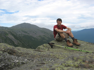
| Another rare self-portrait, up near Mt Washington |
 |
| Looking down into Carter Notch from the Wildcats |

No comments:
Post a Comment