Day 17 - (6/27/16) 14.4 miles (VT 9 Bennington/Woodford to Kid Gore Shelter)
 |
| View from Glastenbury Mountain |
 |
| Above the treeline on the Glastenbury Fire Tower |
'Twas a nice night staying with Mowgli, getting some pizza, a shower, and sleeping in a real bed for once. He drove me to the trailhead around 9am and hiked the first 2 miles with me (barefoot, of course). I was excited to hike through Glastenbury again, which I did last summer and
wrote a piece about, especially to get to the fire tower and look out. Glastenbury is a fascinating town of 8 people and a lot of wilderness, home to
legends and mystery. It started lightly raining and did so for most of the day, my first rain while hiking on this trip, but it never was heavy at all. I made it up the fire tower just after it stopped raining, so it was quite a different view than I had last August. That time it was clear, bright, and sunning; this time it was overcast and cloudy. Climbing up the tower is a really cool experience too because the structure is all open and probably 100ft high or so. You eventually get above the treeline and can see everywhere. The winds begin to hit me you and I get a little touch of vertigo, especially when looking down over the edge. The 10 mile hike in is worth it just to make that climb and have that experience.
Day 18 - (6/28/16) 8.7 miles (Kid Gore Shelter to about half a mile north of Stratton-Arlington/Kelly Stand Rd.)
I'm doing my first night camping outside of a designated shelter or campsite. In CT and MA it was prohibited to do this, but VT in most places you can camp along the trail wherever you can find a spot. I was planning to make it to the road to go into Manchester,

VT tomorrow afternoon, but Mowgli can't pick me up Wednesday but can on Thursday morning, so I'm hiking a little less today and tomorrow than originally planned so I can go into town and don't have to backtrack at all. I'm near the base of Stratton mountain and there is no camping allowed at the top and I heard there might be thunderstorms this evening, so I didn't want to get to the top and not be able to go up the fire tower because of that. I'm trying to figure out if I like this camping better than at a shelter or campsite. It's definitely quitter, that's for sure, but no water source, privy, or company, or anyone to help if something bad were to happen. I think Vermont has been wilder and more remote, a little less altered I suppose, than CT or MA. I've been thinking a lot about the music I heard in a dream about a month ago while taking a nap in my apartment at Bennington and whether I should try to re-create it for my Vermont movement or not. It was incredible music and very complex, but when I awoke I thought that maybe this was the music I should be writing for my symphony.
Day 19 - (6/29/16) 14.3 miles (Half a mile north of Stratton-Arlington/Kelly Stand Rd. to Spruce Peak Shelter)
 |
| The view from the Stratton Mountain Fire Tower |
About an hour after I fell asleep, the rain started and got pretty heavy. Thunder and lightning started up after maybe 20 minutes, but luckily never got too intense. The rain turned lighter eventually and I was able to fall asleep again. Even with my pack out hanging on a tree, everything managed to stay dry. It was still damp and drizzly as I headed up Stratton Mt., whose summit is where the creation of the Long Trail and later the Appalachian Trail were both proposed. The climb wasn't that bad, even as it's the highest peak yet on my hike and the highest in Southern Vermont. It had a fire tower at the top, but it was all foggy and couldn't see any view, so I had an early lunch to kill some time to see if the clouds would part. They did partially and I got a somewhat decent view. The sun later came out and most of the rest of the day was uneventful. Near the end of the day, I got a beautiful view of Manchester and the surrounding mountains at a place called Prospect Rock. When I arrived there, a host of young kids were there. It turned out to be one of the trips that those college kids were being training to lead back in MA. The one leader was very nice, gave me an apple, and the kids asked me a bunch of questions.
Day 20 - (6/30/16) 8.3 miles (Spruce Peak Shelter to Mad Tom Notch/USFS 21)
 |
| On the slopes of Bromley Mountain |
 |
| Above the fog that covers Manchester |
 |
| The buried treasure |
Started the day with a short 3 mile hike to the road into Manchester. I went by Spruce Peak, which didn't have a great clearing to look out, but what I could see was the valley below with the town in it completely filled with clouds and fog, while myself and the surrounding mountains were clear and sunny. It was amazing. I wondered what it was like to be down in that fog at that moment. Mowgli was supposed to pick me up at 10am, but he wasn't there. My phone had died too, so I was unable to see if he had sent me a message about a change of plans. At 11am he still wasn't there, so I had to figure out another way to get to town to resupply despite my aversion to hitching. There was another hiker there and she was thinking about going into town too, so I said I'd feel much better hitching with someone else than by myself at least. Luckily we found a guy there at the trailhead who drove us into town and we went to Starbucks where I could plug in my phone. I did get a message from Mowgli saying he had car problems and couldn't get there until about 11:15am! So I guess I just missed him. Anyways, we met up in town and I got most of what I needed to do done, minus blogging. Got back to the trail around 3:30pm and did as much hiking as I could until it began to get dark around 6:30pm. I hiked to the top of Bromley Mt on the ski slopes, which I'd driven past many times. I found a spot to camp near this forest service road and while I was searching for a place to go to the bathroom, I found a spot behind a big boulder and stumbled on a dark green box hidden behind some rocks. My mind started racing about what could be in it. A bomb? A gun? A million dollars? The remains of someone? I felt like I was in movie or TV show or something. I debated whether I should just leave it alone, maybe it would explode if I tried opening it or something, but decided I was just too curious and tried to open it. In it was a note, which I've kept saying, "Raspberries are red, Blueberries are blue, Here is a Lemonzest Luna bar for you! Accidentally stumbled on your food cache...thought it was a geocache. So I thought I'd leave a gift! Enjoy! - Chocolate '15" So it looks like a hiker, I assume probably female from the handwriting, came upon this box of food last year and added to it, thinking someone had stashed this food and would come back for it soon. There were some Kashi granola bars, a bag of sunflower seeds, Carnation Instant Breakfast mixes, and a non-see-through bag that was just labeled "SPUDS" (I assume instant potatoes). I looked and found the "Best By" dates on some of them as 2011, meaning this box has probably been sitting here for at least 6 years!! Most things weren't vegan, so I only took the Luna Bar (Thanks, Chocolate) who's "Best By" date was April 2016, and put the rest of the box in front of the information kiosk at the trailhead here writing a note saying I found it in the woods here, the food seems old but please take if you are adventuresome and hungry. I hate wasting, so maybe some hiker will appreciate it, and now I have a good story to tell.
Day 21 - (7/1/16) 14.3 miles (Mad Tom Notch/USFS 21 to Little Rock Pond Shelter)
 |
| Mists floating on Little Rock Pond |
 |
| A butterfly trying to sign the trail register |
I knew there would be thunderstorms in the PM, so I hiked pretty fast today, left at 8am and made it to the shelter I was aiming for by about 4pm. It started raining about 5 minutes before I arrived but luckily it was just light rain then and no thunder. The shelter is very nice, although a group of 8 was already here; two families together, each with 2 young kids, camping for the 4th of July weekend. I decided to take the bunk that was open because they seem like a pretty quiet and thoughtful group and I rather keep everything dry tonight as it's supposed to keep raining through tomorrow morning. The pond here is beautiful and the rain had mostly let up, so I cooked my dinner down by the water, but it started to rain again as I was hurrying to eat up and I went back to the shelter. Then the thunder hit and heavy rains with some hail too! I'm very glad I'm in the shelter right now. I saw very few hikers on the trail today, maybe because there is this "Rainbow Gathering" taking place right now just few miles from here where all the hippie-type hikers are going for a day or two. I did meet a very nice young woman and her dog early in the morning at the top of Styles Peak and we talked for maybe 15 minutes. She's doing the Long Trail going South, but hiked the AT in 2010 and 2012 (twice!) After this she is hiking the Pacific Crest Trail, then a trail that spans the top to the bottom of New Zealand, and then the Continental Divide Trail to make something like 16 straight months of hiking! Crazy! We then went our separate ways, but it made me think about the interactions and relationships that happen out on the trail . I'm a pretty introverted person, and I'd just as well do this hike without bumping into anyone. Some people make friends with other hikers headed the same direction and hike together for a while. But most interactions and relationships are short because each is heading a different direction or the same direction but at a different pace. And you only ever learn people's trail names instead of their real names. It is interesting that there are these trail registers at shelters and some other places like state crossings, where people sign in with the date they got there. I think partly it is to keep track of how much the trail is being used and also to better pinpoint where someone might be if they got lost. But people also write whatever they like in them, about their day, what they are going to do, drawings and doodles, and even stories and random things. So even people who have hiked faster than you or in the opposite directions, you can learn more about their journey and where they are by reading their entries in the registers. So the woman I met today is going South on the LT, so the other registers she has gotten to before me in reverse chronological order, and in the register here she wrote this kind of journal entry about her remembering about a romantic day or two she had at one of these shelters when she did the whole trail several years ago. I thought maybe this would be a really good idea for a film, or an opera or something. Two hikers that at first meet each other at the mid-point of their hikes and have a regular friendly and brief interaction, but are hiking in opposite directions and then learn more about each other through their previous entries in the trail registers. Almost like a
"The Last Five Years" type of thing. The Long Trail, and the Appalachian Trail run concurrent for 105 miles from the MA border to Killington, and then the AT turns east towards New Hampshire and the Long Trail keeps heading north for another 170 through Vermont until it ends at the Canadian border. I was thinking maybe Diane and I could do that 170 miles at some point in the near future, as other hikers have told me it is much prettier that this part down here in the South. Maybe I could write a "Long Trail" piece too.
Day 22 - (7/2/16) 16.4 miles (Little Rock Pond Shelter to between Keiffer Rd and Cold River Rd/Shrewsbury, VT)
 |
| A rare selfie |
Sleeping last night wasn't great, mosquitos bothering me and there as some snoring and lots of sounds of people shifting in bed. I prefer my own tent, but at least all my stuff stayed dry. With that 2-family group taking up most of the shelter and me stuck in there with them because of the train, I felt like a stranger crashing in on their family trip. It reminded me of our family camping outings when I was young, although we never did it in the backcountry like them. We always went to a campsite where you drive in, and we always got a lean-to because it always seemed to rain whenever we camped. So, we were all crammed into this shelter and I nearly became a part of the family for a night. I played cards with them and did card tricks for the kids. Kind of strange, but I guess that's what they get camping as a family on the AT in a shelter. I'm camping tonight in a town called Shrewsbury, which is actually where my Grandfather was born and I'm thinking about him tonight. My great-grandfather lived in New Jersey but wanted to try his hand at farming and bought this farm in Shrewsbury, VT and meanwhile my grandpa was born, I think in 1921. Apparently he wasn't any good at farming, so they headed back to New Jersey when my grandpa was only 2 years old. He wanted to be a conductor and went to college for music at Elon in North Carolina, but his father became sick and then WWII broke out and he never finished his studies and never became a professional musician. So I probably owe most of my musical abilities to him. I was thinking also today about how the trail usually is quite thin, maybe 3ft or so wide, but there are so many mini-paths a hiker can take within it. Some hop on the rocks, some on roots, some on the flat ground or go left or right around a rock. Everyone kid of takes their own path and their own way of doing it, but in the end we all get to the same destination. A good metaphor for life? I was also wondering today: what is life to a plant or a fungus? They obviously want to live, they grow and do things so that they can grow and stay alive. But why? Do they feel happiness or something because of being alive? Are they just there to help play a role in the greater world and environment? I really have no idea. Why are any of us beings here? Sometimes when hiking out in the woods with nobody around, I get a feeling that I'm the only person left on the earth.
Day 23 - (7/3/16) 12 miles (Between Keiffer Rd and Cold River Rd to Churchill Scott Shelter)
 |
| From Killington Peak |
My biggest climb yet was today. More than a 2000ft climb up Killington Peak. May phone died yesterday, and I needed to call my parents to figure out meeting me at Route 4 tomorrow to go into Rutland, and luckily from the shelter near the summit it was just .2 miles (although a very steep and rocky .2 miles!) up to the summit which has a lodge as it's part of the Killington Ski resort. I was able to find an outlet, but I had to make my way through a sea of tourists and mountain bikers who all took the gondola up to the top. I felt proud knowing that I had hiked my way up there, to 4200-some feet. But I was also get weary of hearing musak and being around them all as I was waiting for my phone to charge. I was anxious to get away from the noise again and back to the trail. It was a beautiful view at the top, but too many people and too much noise. I'm now at less than 500 miles to Katahdin! I'm starting to get used to pondering questions for a while rather than simply going online and looking them up. For example, I was thinking about 2 different songs that mention the word "Lea" but I didn't know what it meant. Usually I'd just google it and instantly known, but here I had to sit with that uncertainty for a few days, and of course my life was no less rich for having to do so. It makes me wonder about how much our lives have been changed and how much they have been improved or not by the internet. On the trail I can ponder this very question and I probably wouldn't even get a satisfactory answer from google anyways. (By the way, a "Lea" is just a green, grassy field in case you hadn't yet googled it yourself.)
Day 24 - (7/4/16) 11.9 miles (Churchill Scott Shelter to Stoney Brook Shelter)
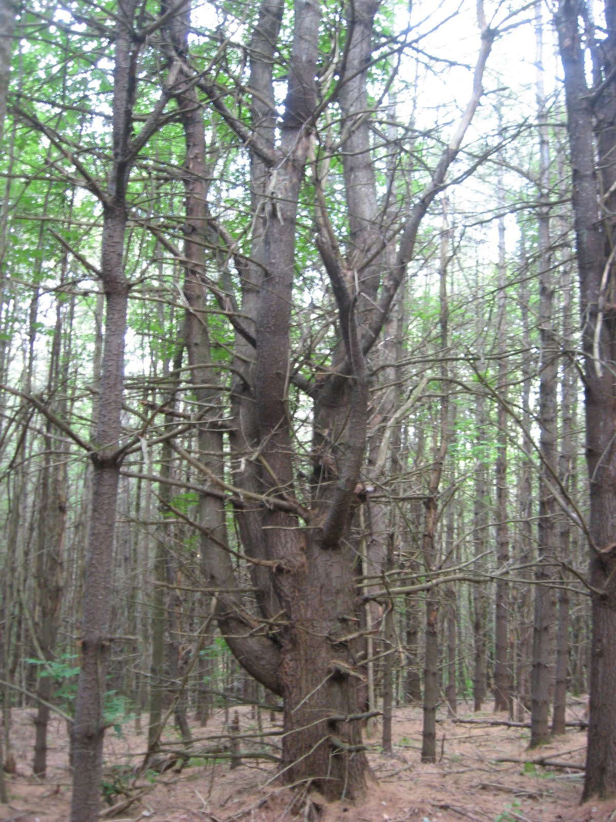
 |
| Stone Cairns |
Hiked an easy 2 miles this morning to Rt 4 where Mom, Dad, and Vale met me in the VW camper van to go into Rutland. I got groceries and lunch at the Yellow Deli, which is also a hiker hostel and it seems everyone else I've met out here went into to stay there for at least a night. It was nice to spend some of Independence day with my family, but I still had a lot of hiking to do that day. I got back to the trailhead around 1:30pm and tried to do 10 miles of hiking from there. I shortly hit the "Maine Junction" where the Long Trail heads north to Canada splitting from the AT which goes east to New Hampshire. So now I've finished 105 miles of the 272-mile Long Trail. Shortly before getting there, I ran into 2 older ladies who were lost and trying to find a certain nearby hotel. It was on my guidebook and map, so I was able to give them directions. Maybe 15 minutes later, I came upon them again and it looked like one of them had had some sort of accident. She somehow fell and hit her nose on the ground or a rock or something. I opened my first aid kit to see what could offer, meanwhile the other lady kept saying how poor a nurse she would be and didn't know what to do, so I had to step up and do what I could. Luckily my mom is a nurse, so I have a little bit of knowledge on what to do. It looked like she just had a bloody nose, a little cut under her eye and maybe on her head as well. I gave her an alcohol wipe and told her to keep pinching her nose until the bleeding stopped and I stayed with them for 15 minutes or so until the bleeding was done. It turns out they are both kindergarten teachers from Seattle, probably in their 60s I'd guess. They've already hiked the bottom half of the AT and are doing the Vermont section this summer, which they said is definitely the hardest part yet for them. I got back to hiking and tried to finish these 10 miles and had a really tough time going up Quimby Mountain: 1.7 miles with a 1250ft climb which was no fun at all. I finally made it here though, and just 3 more days of hiking until New Hampshire and my first day off!
Day 25 - (7/5/16) 13.3 miles (Stoney Brook Shelter to VT 12/Barnard Gulf Rd)
I felt off all day today. I didn't feel very well this morning and I'm not sure what it was, but the first couple of climbs, they weren't huge, but they were killing me. I felt a little better as the day went on, but I was grumpy all day and wondering why these hills exist anyways and why the trail has to go up and down every single one of them! At the shelter last night, it was just me and one other guy, which is the least it's been yet at a shelter. Then today, besides seeing that guy at the shelter in the morning
 |
| The trail through the tall grass |
before I left, I saw only one other person on the trail all day, another record so far. I did see another beat today too. It was far away and rain off quickly through the thick woods and I only caught a very short glimpse of it and to me it looked like a gorilla, but I figured it had to be a black bear as I don't think there are any zoos around. When I'd finished my target miles for the day, I started searching for a place to camp as the next shelter isn't for miles. The trail came to an open field maybe .1 miles before hitting route 12. I found a flat patch of ground and pitched my tent and got inside to lay down for a little while and escape from the bugs. After a few minutes, I heard something next to my tent that was really close, a kind of breathing or panting sound. I first thought it was another person, but then it seemed like maybe it was a couple of dogs, but I never heard and speaking or people near by. But it seemed then to be bigger than just some dogs and then it hit me, maybe it's a bear! I got out the whistle from my pocket and blew on it a few times, but it didn't move away. After blowing on it a few more times with it still not moving, I figured I had to get out of the tent and see what it was. I got up the courage to peak outside and it was...a bunch of cows. About 10 cows who must have just been curious as to why this yellow structure was now in their field. I was quite relieved, but moved my tent just outside of the field and they eventually lost their curiosity and left. I hope they don't bother me in the middle of the night!
 |
| Curious Cows |
Day 26 - (7/6/16) 14.4 miles (VT 12/Barnard Gulf Rd to Podunk Rd/Podunk Brook)


Well, I didn't feel bad like I did yesterday, which was great, except that today I had some sort of allergy attack; I was sneezing like crazy all day, nose constantly running, eyes itchy and red. And to top it off, the swarm of little flies constantly circling around my head led to about 4 incidences of a fly coming straight into my left eyeball. I couldn't hike for about a half-hour at one point because my left eye was bothering me so much that I couldn't see straight. So I really hate flies and mosquitos now. Also in the morning, if you happen to be the first hiker going through that terrain that day, you run in to a ton of spider web strands that have been made overnight across the path that you can't see but can certainly feel hitting your face, which is very annoying. This part of Vermont doesn't have any very tall mountains, but it has a ton of small and steep hills, which is also very annoying, especially when it is 90 degrees out like today. One hill today was only .4 miles in length but a 600ft climb in elevation. Can you tell I need a little break from the trail? Besides being smellier than a wildebeest and sore all over and my left big toe being numb (I hope that's not a bad sign), I'm generally doing alright. I went over the White River today, through West Hartford, and under I-89 near the end of the day. I stopped in the library in West Hartford, which was really tiny, with some kids and an old lady in it who offered me a popsicle, which I couldn't refuse on a hot day like this. I can't remember the last time I had a popsicle, but I used to eat them by the box during summers as a kid. I think I've gotten pretty used to being out here in the woods. At first, I'd here something rustling nearby and I'd think it might be some scary animal, but I've learned that 95% of the time it's just a chipmunk. Some of the forests I've been through are just amazing. One the other day was completely carpeted in ferns that rose up the hillside, like being in a room with green carpet and green wallpaper. I'm camping tonight in a pine forest where nearly every tree has all these old, maybe dead, bare branches sticking out everywhere, as far as the eye can see.
Day 27 - (7/7/16) 7.8 miles (Podunk Rd to Hanover, NH)
 |
| Fern Carpet and Wallpaper |
I woke up at 6:30am to try and make this hike today as short as possible. It's Diane and my 4th wedding anniversary and I've been trying to hike as much and far as I can to get to Hanover by today to see her. I told her I'd probably arrive in Hanover in the evening after she was done with work, but I knew I'd get in early, plus I knew there were thunderstorms coming in the evening. It was nice to get to actually walk a bit on the road when the sun wasn't out. It was about 2.4 miles of road walking in Norwich, VT, some of it on nice back roads, then crossing until I-91 and over the bridge and the Connecticut river to New Hampshire! 3 states and 291 miles down now! I got to the Dartmouth green at 11:45am, mom picked me up, I showered and got cleaned up and surprised Diane at work with flowers. Tomorrow is my first day off after 27 days straight of hiking an average of about 11 miles a day. Now the first big section of my hike is complete. Now on to the White Mountains!
 |
| The Connecticut River; the border between Vermont and New Hampshire |


 VT tomorrow afternoon, but Mowgli can't pick me up Wednesday but can on Thursday morning, so I'm hiking a little less today and tomorrow than originally planned so I can go into town and don't have to backtrack at all. I'm near the base of Stratton mountain and there is no camping allowed at the top and I heard there might be thunderstorms this evening, so I didn't want to get to the top and not be able to go up the fire tower because of that. I'm trying to figure out if I like this camping better than at a shelter or campsite. It's definitely quitter, that's for sure, but no water source, privy, or company, or anyone to help if something bad were to happen. I think Vermont has been wilder and more remote, a little less altered I suppose, than CT or MA. I've been thinking a lot about the music I heard in a dream about a month ago while taking a nap in my apartment at Bennington and whether I should try to re-create it for my Vermont movement or not. It was incredible music and very complex, but when I awoke I thought that maybe this was the music I should be writing for my symphony.


 Well, I didn't feel bad like I did yesterday, which was great, except that today I had some sort of allergy attack; I was sneezing like crazy all day, nose constantly running, eyes itchy and red. And to top it off, the swarm of little flies constantly circling around my head led to about 4 incidences of a fly coming straight into my left eyeball. I couldn't hike for about a half-hour at one point because my left eye was bothering me so much that I couldn't see straight. So I really hate flies and mosquitos now. Also in the morning, if you happen to be the first hiker going through that terrain that day, you run in to a ton of spider web strands that have been made overnight across the path that you can't see but can certainly feel hitting your face, which is very annoying. This part of Vermont doesn't have any very tall mountains, but it has a ton of small and steep hills, which is also very annoying, especially when it is 90 degrees out like today. One hill today was only .4 miles in length but a 600ft climb in elevation. Can you tell I need a little break from the trail? Besides being smellier than a wildebeest and sore all over and my left big toe being numb (I hope that's not a bad sign), I'm generally doing alright. I went over the White River today, through West Hartford, and under I-89 near the end of the day. I stopped in the library in West Hartford, which was really tiny, with some kids and an old lady in it who offered me a popsicle, which I couldn't refuse on a hot day like this. I can't remember the last time I had a popsicle, but I used to eat them by the box during summers as a kid. I think I've gotten pretty used to being out here in the woods. At first, I'd here something rustling nearby and I'd think it might be some scary animal, but I've learned that 95% of the time it's just a chipmunk. Some of the forests I've been through are just amazing. One the other day was completely carpeted in ferns that rose up the hillside, like being in a room with green carpet and green wallpaper. I'm camping tonight in a pine forest where nearly every tree has all these old, maybe dead, bare branches sticking out everywhere, as far as the eye can see.

No comments:
Post a Comment